Hello friends and family!
It’s been another two or so weeks, and we have officially hit the 45 day milestone. That’s 45 days of sleeping on a 5-inch foam mattress cut into four pieces to fit our folding bed. 45 days of making outhouse runs and scrubbing ourselves with camp soap in freezing streams. 45 days of cooking over our little propane stove and hunting down drinking water. 45 days of swatting mosquitoes that enter the van through inlets unknown to torment us as we attempt to sleep. However, everything that I thought was going to be a chore coming into this life has just become part of the routine. I think that’s called “adaptation”.
Speaking of adaptation, travelling in the time of Covid has been one long process of adjustment to the new normal – and of course, the new normal varies province-to-province and town-to-town. We quickly adjusted to the everpresent sign: “Closed due to Covid 19”. It hangs on washroom stalls, shower doors, visitor centres along the trans-canada highway, and museum websites as they regret to inform us that they will be closed until the fall. The usual roadside stops are shuttered and boarded up. The chip trucks molder in parking lots, the highway taverns are past last call, and the little home cookin’ establishments that can’t comply with onerous public health regulations are locked up tight. At the most extreme end, most of the Indigenous reserves we’ve passed have had full blockades on all entry roads, manned with pickup trucks and blocked off by concrete boulders. Some places conceal their closures under “closed for renovation” signs, taking advantage of their idle time to spruce the place up a bit and bring it up to code.
Some places allow us to enter, and then we face another obstacle: the five or six pieces of printer paper taped to the doors, which contain information we must read and absorb before entering their establishment. They scream to STOP: sanitize hands, maintain social distance, read these Covid guidelines (usually a 3-page, small-font guide to existing inside their store that outdoes CRA tax guides for length and complexity). We try to comply, keeping our hands permanently dried out with the spritzes of sanitizer, and our masks balled up in our pockets just in case. It’s been a real experience to go cross-country at this time, constantly navigating the complex anxieties: should I go to a bar and possibly endanger (or be endangered by) a waitress? Should I just tip better? Should I go grocery shopping in this tiny town and risk bringing a virus into a community that doesn’t take the precautions we take in Toronto? When I wear a mask in a town where they aren’t mandatory, are people looking at me funny? And when people ask me where I’m from, why do I hesitate when replying “Toronto”? Is it because I think that they think that Toronto is a cesspool of Covid, or is it because I think that?
Nonetheless, the way we travel at least minimizes the risks. The biggest impact on our plans has been the closure of showers and museums, but the more rural we get, the less it seems to matter. At times it almost feels normal: when we’re hiking or sitting on a beach or a small-town patio, it feels like summer 2019.
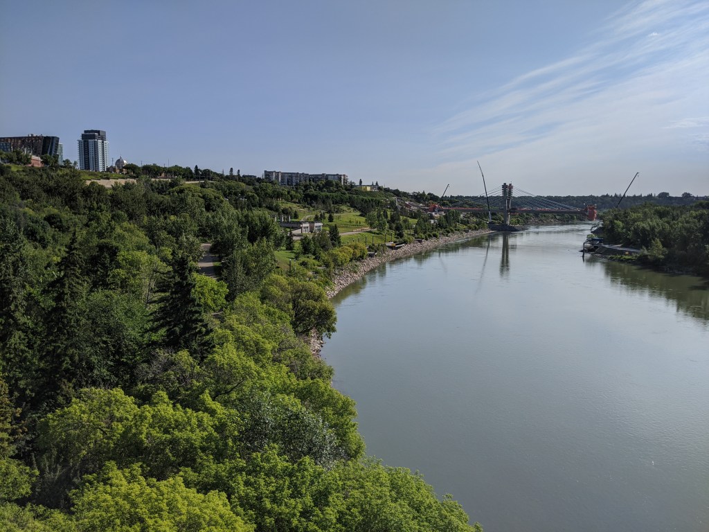
I believe the last time I wrote we were just in Saskatoon, headed west into Alberta. That drive was broken up only by a stop in Elk Island National Park, a bison preserve with opportunities to view those big-headed, rather glamorous creatures, who choose to graze within camera-sight of the main road. We watched a large male bulldoze his girlfriend for wandering into his good side. From there we stopped in Edmonton, which charmed us immensely with its river ravines and craft breweries. I know, I know: winters in Edmonton, the cold, the snow, etc. But nonetheless, summer in Edmonton was a joy, and we spent a day wandering around town, riding the funicular, and getting lost. Sometimes the pandemic is a blessing: as traditional tourist attractions are shut down, we end up sitting in municipal parks with the van doors open, people-watching as every hard-bodied youth in Edmonton plays spikeball and takes advantage of their narrow window of sunlight.
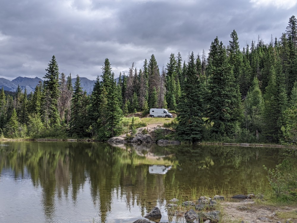
The bulk of our time since Edmonton has been spent in the Jasper-Mt Robston-Valemount area. Two years ago we came through the Rockies and did some great hikes along the Icefield Parkway in Jasper, so we decided to this time direct our focus to the townsite and Maligne Lake areas. We found a free campsite in Jasper, a dirt lot just outside the east boundary of the park (and right across from a brewery, of course), where we spent several nights. During the days, we explored the breadth of Jasper. The town of Jasper is bounded by the railroad tracks that carry stacks of multi-coloured boxcars, and from above the town looks like a miniature hamlet in a model railroad set. We hiked the punishing 9km/1200 metre Whistler’s peak, which most (sane) people access through the skytram gondola – and not realizing we could take the skytram down for free after scaling the peak, we also hiked back down, to the chagrin of our knees. We put our toes in the ice-cold turquoise waters of the Athabasca River, and fled to the slightly less frigid Annette Lake, where we swam each day to wash the sweat off (as incredulous locals congratulated us on our “bravery”). We were fortunate to intersect with my cousin Sam, who is basically a Jasper local. She directed us to Maligne Lake, an area south of Jasper with incredible alpine hiking in the verdant Opal Hills, and a glacier-fed lake too cold even for us to swim in. It was down in that area that we carefully drove alongside a mother and child duo of gangly moose, and came to a roadblock of mountain goats strutting down the centre of the highway.
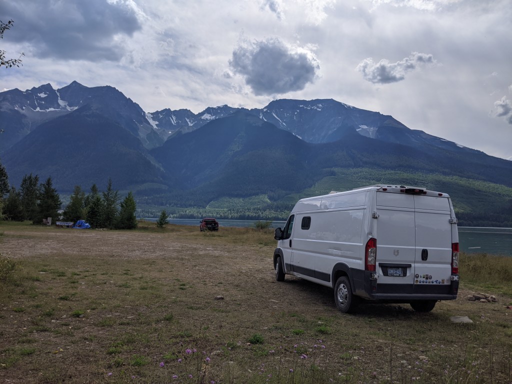
Heading west from Jasper, we stopped in to admire Mt. Robson; at about 3,000 metres, it’s the tallest peak in the Canadian Rockies. Though it spent most of its time modestly veiled in a cloud, we managed to glimpse its peak and glaciers on a clear day while visiting a few local waterfalls. Just south of the mountain, the town of Valemount is a mountain biker’s paradise – however, I am bike-challenged and got the heebie-jeebies just looking at the steep trails, so we hiked instead to an alpine meadow. An optional summit trek (i.e. a barely marked uphill slog through shifting shale rocks) led us to a 360 degree view of the Rocky and Cariboo mountain ranges. It only cost us a few scrapes and a bee sting!
Most recently, we headed west from Valemount towards Prince George, a lumber hub where the foul smell of the pulp mill sits in the bowl of the city like a heavy cloud. Along the way we stopped in at the Ancient Forest Provincial Park, which holds 1000-year old stands of cedar trees, which tower over the spruce forests, coated in gold-dust lichen and old man’s beard. These mystical trees were about to be logged in the early 2000s until a grad student stumbled across them and realized they needed protection. Some trees still bear the spray paint of logger markings. The park is a wet paradise suffused with the smell of cedar bark, ferns, rotting nurse logs and devil’s club – I spent the entire hike sniffing the air, certain I was becoming healthier with every breath.
We are now headed south through the Cariboo mountains, possibly taking a little detour to Kamloops, and then onwards to the coast! Please send us any recommendations for Vancouver and the island.
